
AURIN has partnered with researchers at Curtin University to make building-scale photovoltaic potential data available through the AURIN Data Provider.
The data provides detailed estimates of rooftop solar generation potential across approximately 16,000 building footprints in Kalgoorlie-Boulder, Western Australia. It is designed to support research and decision-making related to renewable energy, climate action, distributed energy systems and regional energy resilience.
By bringing together building footprints, solar irradiance, meteorological information and photovoltaic system assumptions, the dataset helps users examine how much energy individual buildings could generate from rooftop solar. It also makes this information available in a consistent, research-ready format that can be queried, mapped and aggregated for further analysis.
What the photovoltaic potential data provides
The Kalgoorlie-Boulder photovoltaic collection includes several related datasets that support analysis at different levels of detail.
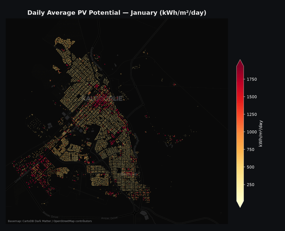
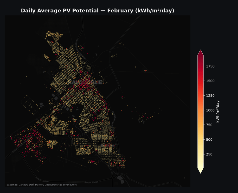
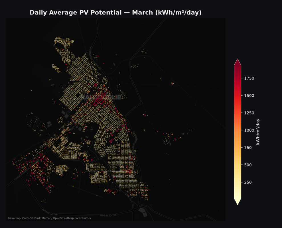
The daily average dataset provides estimated photovoltaic energy output for individual buildings across different months. These estimates account for panel efficiency, temperature effects and the optimal placement of panels within each rooftop geometry.
The monthly cumulative dataset provides monthly and annual energy generation totals for each building. These energy budget metrics are particularly relevant to economic feasibility studies, renewable energy target setting and strategic planning.
Users can also access hourly photovoltaic potential data for studies requiring greater temporal detail, such as grid integration, demand matching and battery storage analysis. Supporting irradiance, weather, building footprint and mesh block datasets provide additional context for analysis across buildings, neighbourhoods and regions.
Together, these datasets provide a more detailed basis for understanding the potential contribution of rooftop solar across the Kalgoorlie-Boulder area.
Supporting renewable energy planning and analysis
Rooftop solar is an important part of Australia’s transition to a lower-emissions energy system. However, effective planning requires more than identifying buildings with suitable roof space.
Researchers and decision-makers also need to understand where generation potential exists, how much energy could be produced over time and how distributed energy resources may interact with local infrastructure and energy demand.
The building-scale photovoltaic data can support a range of applications, including:
- Energy consultants conducting early-stage solar assessments and pre-feasibility studies.
- Local governments assessing progress against climate action plans and exploring achievable renewable energy targets.
- Property developers and asset managers evaluating solar investment across individual buildings or property portfolios.
- Financial analysts using annual generation estimates to inform cash flow and investment modelling.
- Energy researchers investigating distributed generation, demand matching and local energy resilience.
- Urban and regional planners aggregating building-level estimates to examine renewable energy potential across neighbourhoods, cities and regions.
Because the data is available at building footprint level, users can move between individual site analysis and broader spatial assessments. This allows researchers to examine both the potential of particular buildings and the cumulative contribution of rooftop solar across a community.
Relevance for regional and remote Australia
The dataset is particularly relevant to regional locations such as Kalgoorlie-Boulder, where energy security, infrastructure costs and access to reliable energy can create significant planning challenges.
More detailed information about local renewable energy potential can help researchers and decision-makers investigate options for more resilient and decentralised energy systems. It can also support analysis of how local generation may contribute to energy needs across different building types, locations and time periods.
This type of evidence can inform future research into renewable energy planning, infrastructure investment and the relationship between energy systems and regional development. It can also help identify where further technical assessment or community-level planning may be warranted.
How to access the data through AURIN
The photovoltaic potential datasets are available through the AURIN Data Catalogue and can be accessed through the AURIN Data Provider.
Relevant datasets include:
- Kalgoorlie-Boulder Photovoltaic Potential Maps: Monthly Cumulative Potential Values
- Kalgoorlie-Boulder Photovoltaic Potential Maps: Daily Average Potential Values
- Kalgoorlie-Boulder Photovoltaic Potential Maps: Monthly Cumulative Irradiance Values
The datasets are available under a Creative Commons Attribution 4.0 licence. Users can also access supporting documentation, including the data dictionary, usage examples, processing methodology and software stack information.
Access to the AURIN Data Provider is available to authenticated Australian researchers. Users from eligible Australian Access Federation organisations can log in using their institutional credentials. Other users may need to apply for an AAF Virtual Home account before accessing the Data Provider.
Extending the value of research data
The Kalgoorlie-Boulder photovoltaic collection demonstrates the value of collaboration between university researchers and national research infrastructure.
Research-derived data can be difficult for others to locate, prepare and reuse. By making the collection available through the AURIN Data Provider, AURIN helps extend its value beyond the original research project and creates opportunities for further analysis across energy, planning, infrastructure and regional development.
The data also supports AURIN’s broader role in reducing the technical and practical barriers involved in working with complex spatial information. Researchers and decision-makers can access consistent, documented datasets without having to assemble multiple sources or repeat the full modelling process before beginning their analysis.
Through partnerships such as this, AURIN is helping strengthen the evidence base for Australia’s energy transition and support more informed planning for resilient cities, regions and communities.