WHY AMBIENT DATA?

National Coverage
100% of Australia

Granular
Individual Building Facades (3D)
Sources
Road, Rail, & Aircraft
100% of Australia
Individual Building Facades (3D)
Road, Rail, & Aircraft
This dataset represents a strategic national 3D model designed to quantify the acoustic footprint of road, rail, and aircraft activity across Australia. Representative of the year 2018, this dataset was built using sophisticated environmental noise modeling software (SoundPLAN) to calculate exposure levels for over 15 million buildings. Unlike previous localised studies, this model integrates diverse data streams, including GPS “probe counts” for 3.47 million road segments, 3D flight trajectories from radar tracking, and national rail timetables, while accounting for physical variables like terrain elevation and building heights.
See how this dataset has enabled strategic planning, public health, and spatial intelligence platforms.

Transforming property valuation with traffic noise insights

Exploring how the transport noise affects Victorian’s health

See how the noise data enable urban decision support systems.
Building-level day and night noise data based on Geoscape Building Footprint (as points) data for individual noise reflecting sources like road, rail, and aircraft.
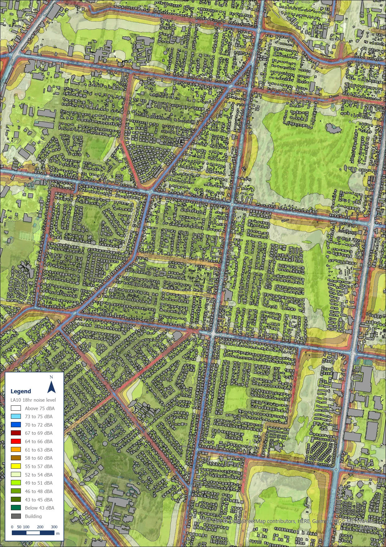
Raster representations of noise data provide a broad overview of noise distribution across areas. These include separate representations for road, rail, and aircraft noise, during both day and night, with raster resolutions ranging from 10x10m to 50x50m.
Unlock the potential of noise mapping to elevate geospatial analysis with the Ambient Maps Noise Mapping Datasets. Whether you’re exploring the property market, urban environments, transportation networks, or community well-being, the products offer invaluable insights to drive meaningful discoveries and informed decision-making.
Contact us to learn more about accessing the Ambient Maps Noise Mapping Datasets.
Contact US